Québec to
Prince Edward Island
The grand Atlantic Canada passage — from the walled city of New France to the red sand beaches of Canada's smallest province, across the world's longest bridge over ice.
There is a particular kind of quiet that settles on Atlantic Canada in summer — salt air, green fields rolling to the sea, lobster suppers in converted barns, and roads empty enough that a Prevost coach feels unhurried for the first time all trip. This journey starts in the most historically charged city in North America and ends on an island defined by red sand, warm ocean water, and the most celebrated lobster in the world.
The Confederation Bridge crossing alone is worth the journey. But the route demands preparation: French road signs through Quebec, speed camera corridors in New Brunswick, and PEI's soft clay verges that can swallow a coach tire. This guide covers everything a Prevost owner needs to know before mile one.
Route Map
Hover any marker for details — Rick's Picks, coach notes, fuel stops, and campgrounds.

Must-Stop Destinations

Old Québec City
The only fortified city north of Mexico, and the most European place in North America. The walled Haute-Ville sits on a 300-foot promontory above the St. Lawrence River, its stone streets and 17th-century architecture unchanged from the age of New France. Base yourself at the Montmorency Falls KOA — 10 minutes from the city walls — and spend two days here. One is never enough.
Park at Montmorency Falls KOA (just east of Old Quebec) and shuttle into the city. Coaches cannot navigate the narrow streets of the old town. The KOA has a shuttle service in peak season — confirm timing when you book.
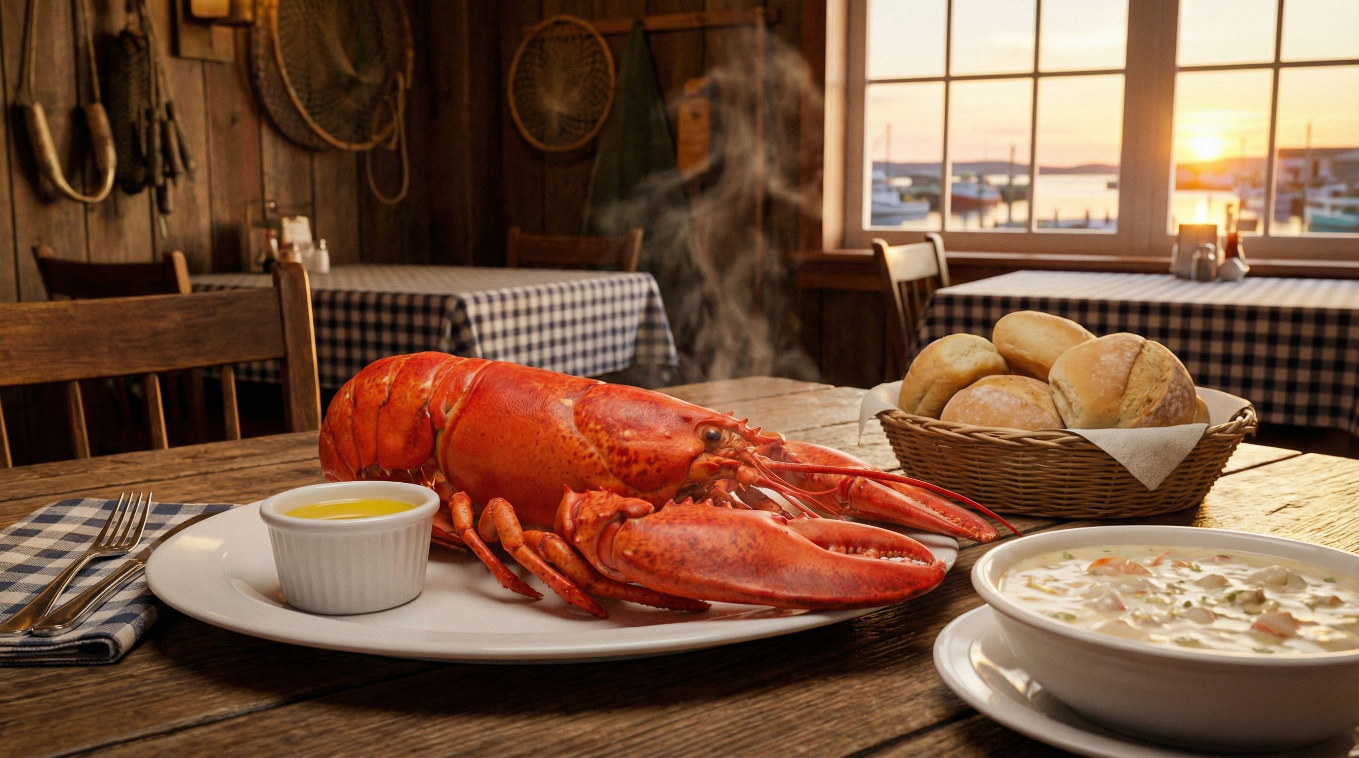
New Glasgow Lobster Suppers
The most legendary meal in Atlantic Canada. The New Glasgow Lobster Suppers barn has been serving whole lobster with chowder, mussels, and homemade rolls for over 60 years. The parking lot handles coaches with ease. Come hungry. In peak July–August season, lines form before the doors open at 4 PM.
Arrive by 3:45 PM for the 4 PM opening in peak season. The large gravel lot on the east side of the property handles coaches up to 45 feet easily. Bring cash for tips — they still prefer it here.
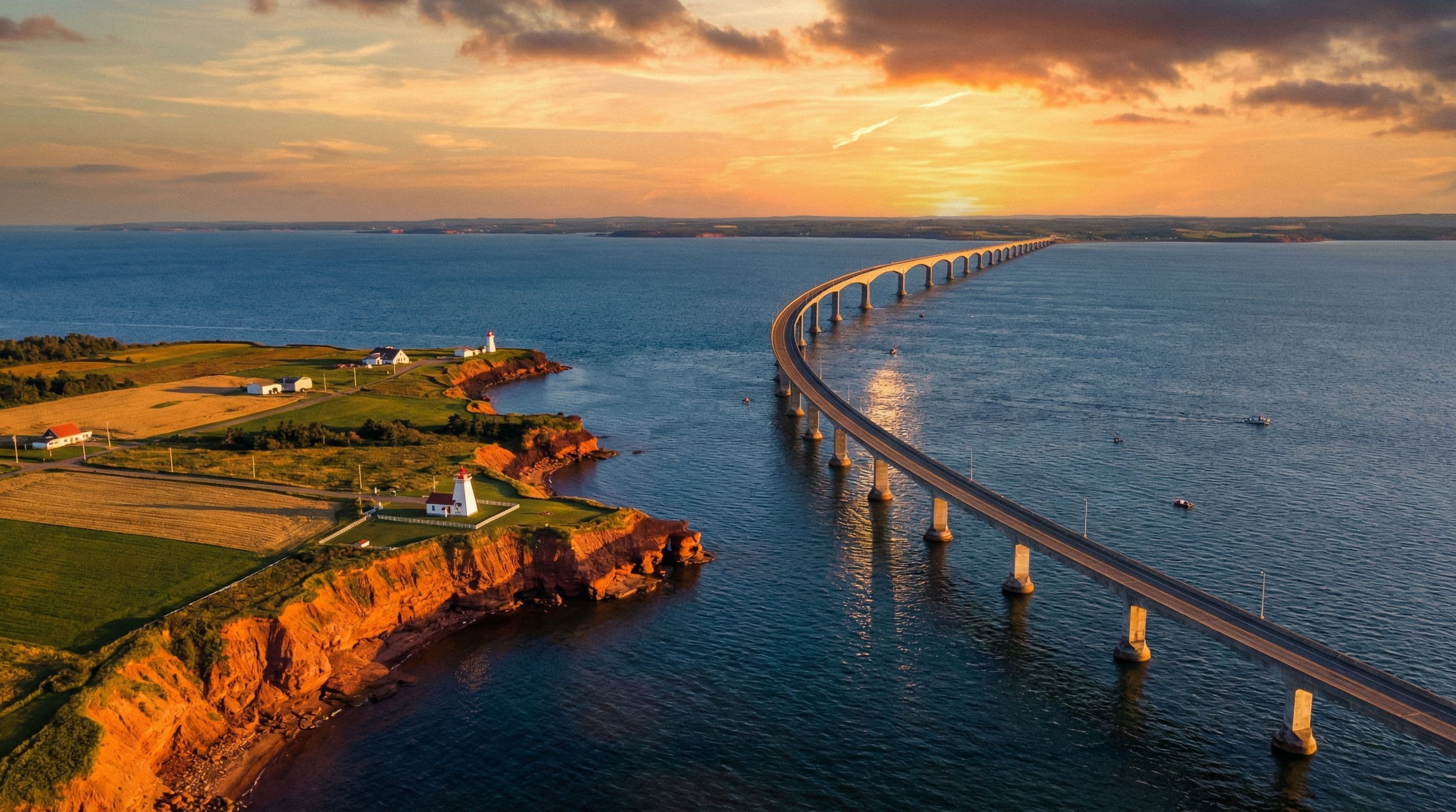
Confederation Bridge
At 12.9 kilometers, it is the longest bridge in the world over ice-covered water, and one of the great engineering achievements of the 20th century. Crossing it in a Prevost at sunrise or sunset — the red sand cliffs of PEI materializing ahead and the Northumberland Strait glittering below — is a moment that passengers remember for years.
No toll entering PEI. Toll applies when leaving (currently $50 CAD for 2-axle vehicles, higher for coaches). Pay at the booths in Borden-Carleton when departing. The bridge is open to all vehicle sizes — no height or weight restrictions.
Coach Road Notes
All road signage in Quebec is French-only. Exit numbers, services, and distance are in metric (km). Download Google Maps offline before entering Quebec Province.
Key terms: Sortie = Exit, Prochaine = Next, Km/h speed limits. US GPS works fine — just watch the language mismatch on road signs vs navigation.
Route 185 between Rivière-du-Loup and the NB border has automated speed enforcement. Cameras are fixed and well-publicized. Speed limit is strictly 100 km/h (62 mph). Fines are substantial.
The TCH-2 (Trans-Canada) through NB is 110 km/h. Route 185 is lower — do not confuse the two.
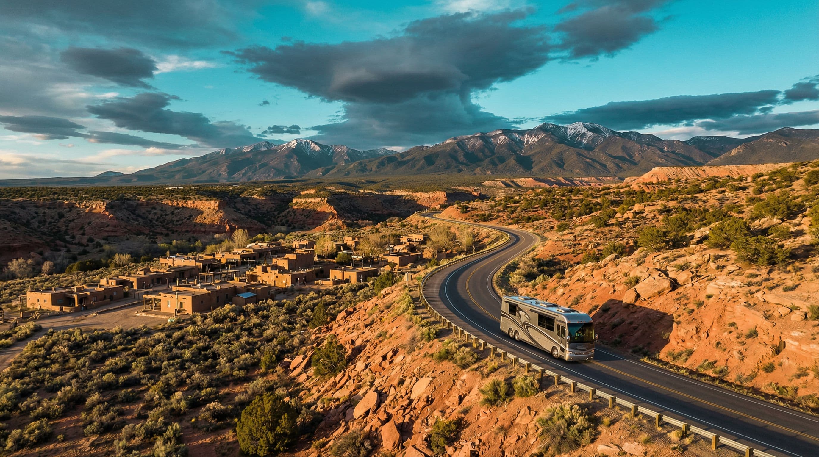
Prince Edward Island's secondary roads are narrow with soft red clay verges. Pulling off on unmarked shoulders risks sinking. Stick to primary routes (TCH-1 and Trans-Canada connector) and use designated large-vehicle pull-offs.
The island's main highways handle 45-foot coaches without issue. Problems arise only on the secondary red-dirt back roads.
The bridge is occasionally closed to high-sided vehicles (including coaches) during severe wind events. Check bridge status before departing for the crossing.
Bridge status: 1-800-565-0520 or confederationbridge.com. Closures are rare but can last several hours.

“Across the world's longest ice bridge — into the most peaceful island in North America.”
Fuel Stops
Places to Stop
Montmorency Falls KOA
2050 Blvd. Sainte-Anne, Beauport, QC
Sackville RV Park
17 Bridge St, Sackville, NB
Cavendish KOA
836 Forest Hill Ln, Cavendish, PEI
Known Hazards
Metric Speed & Distance
BE AWAREAll road signs in Canada display metric measurements. 100 km/h = 62 mph. 110 km/h = 68 mph. Set your GPS to metric or do the mental conversion before crossing the border.
Entire Canadian portion of route
Early Season Frost (Oct–Apr)
USE CAUTIONEastern Canada can experience overnight frost and road ice from October through April. The Confederation Bridge closes to high-sided vehicles in severe wind events — check bridge conditions before departing.
New Brunswick and PEI — October onwards
Canadian CVSA Inspection Zones
BE AWARECommercial vehicle inspection stations are active on Trans-Canada corridors. Large motorcoaches may be directed to stop for inspection. Carry your coach registration and insurance documents at all times.
Trans-Canada checkpoints — NB and QC
Pro Tips
Atlantic Canada Tour
2026
August 14 – 18 · Charlottetown, PEI · Cavendish KOA base
Road Hogs crosses the Confederation Bridge for their first-ever Atlantic Canada rally. Five days exploring red sand beaches, world-famous lobster suppers, and the rolling green hills of PEI. The convoy rolls through Old Québec City on the drive east — a full week of the best scenery in eastern North America.